
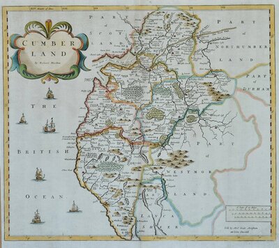
Cumberland Maps
Westmorland Maps
( Page 1 of 4 )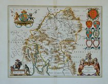
Jan Blaeu 1645
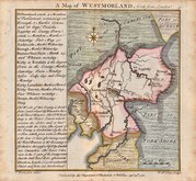
Emanuel Bowen 1720
Emanuel Bowen 1720
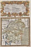
Robert Morden 1722
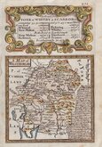
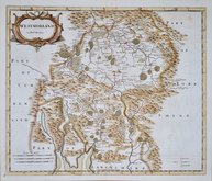
Thomas Badeslade 1741
Robert Morden 1753
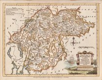
Robert Morden 1773
Joseph Ellis 1773


6x10 cm
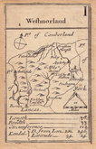
I | Westmorland | 1
Robert Morden first issued this series of maps as playing cards 'The fifty-two countries (sic) of England and Wales described in a pack of Cards' in 1676 with stencilled suit marks in red and black. They were re-issued later the same year with the maps amended to include the names of adjoining counties and in a third issue in 1680 with minor amendments to places and roads for most counties and with many place names symbols changed from circles to iconographic symbols. The maps were not seen again for nearly a hundred years when they were re-issued for the last time, with no revisions to the maps, by Homan Turpin, a London bookseller, in his Brief Description of England and Wales; containing an account of each county... in about 1773. The playing card maps were originally engraved and printed several to a plate and were then trimmed and pasted to card. The maps for this issue were cut and pasted onto pages and bound in book form without stencilled suit marks.
A very rare map in good condition of the map of Westmorland, originally issued as the Ace of Clubs, cut and pasted as issued without stencilled suit mark from the Turpin edition c.1773
Quick Links
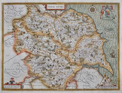
Yorkshire Maps
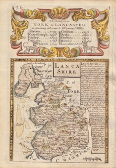
Lancashire Maps
×