
Lancashire Maps
Westmorland Maps
( Page 1 of 4 )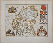
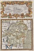
Jan Blaeu 1645
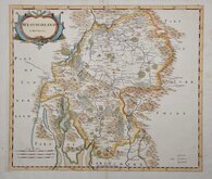
Robert Morden 1695 [1722]
Robert Morden 1695 [1753]
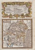
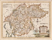
Emanuel Bowen 1720
Emanuel Bowen 1720
Joseph Ellis 1765 [1773]
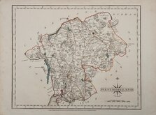
John Cary 1787
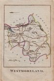
Robert Butters 1803


12x18 cm
FROM "OWEN & BOWEN" POCKET ROAD ATLAS BRITANNIA DEPICTA.
A MAP of WESTMORLAND
Map set below a decorative cartouche containing the title and details of the road from York to Whitby & Scarborough.
Road map of the first part of the route verso.
Engraved text descriptions alongside the county map and alongside and below the road map.
Engraved by Emanuel Bowen (1693?-1767) and published in the pocket road book Britannia Depicta by Thomas Bowles from 1720 to 1764. The county maps were based on Robert Morden's small series published in The New Description and State of England... from 1701. Text descriptions compiled by John Owen.
Some marking around the road map.
For full description of the road, go to category: Maps > British Isles > RoadMaps > Owen & Bowen. For more information on Britannia Depicta, see the category heading under Road Maps > Owen & Bowen.
Quick Links


Cumberland Maps

Yorkshire Maps
×