
Lancashire Maps
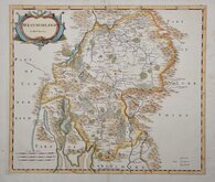
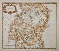
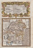
Westmorland Maps
( Page 1 of 4 )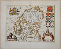
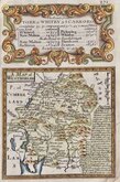
Jan Blaeu 1645
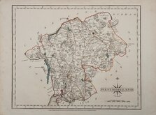
Robert Morden 1695 [1722]
Robert Morden 1695 [1753]
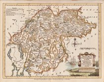
Emanuel Bowen 1720
Emanuel Bowen 1720
Joseph Ellis 1765 [1773]
John Cary 1787
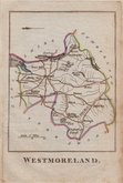
Robert Butters 1803


42x37 cm
FIRST MAP OF THE COUNTY TO SHOW LONGITUDE FROM LONDON
WESTMORLAND by Robt. Morden
Sold by {Abel Swale Awnsham & Iohn Churchill
Copper engraving produced by Robert Morden for publication in Edmund Gibson's translation of William Camden's Britannia first published by Abel Swalle and Awnsham & John Churchill in 1695. Sutton Nicholls (1668-1729)and John Sturt (1657-1730)have signed some of the maps as engravers but other engravers were also probably employed.
This is the first series of maps to mark longitude in minutes of time (top border) as well as in degrees (bottom border). For most counties, longitude is based on the meridian of St. Paul's, London. They were the first folio sized series of county maps to show roads, Robert Morden using the road maps of John Ogilby's Britannia published 20 years earlier.
Camden's Britannia with the Morden maps was republished in 1722, 1730, 1753 and finally, in 1772. Many plates were updated for the 1722 edition, mostly with changes to place name spellings, and all were reworked for the 1753 edition due to plate wear.
The work was republished in 1722, 1730, 1753 and, finally in 1772. There were a number of minor alterations to most plates in the series during the early editions and many were substantially updated for the 1722 edition mostly with changes to the spelling of place names. The plates were reworked, due to wear caused by the printing process, for the 1753 edition.
Robert Morden (fl. 1669-1703) mapmaker, mapseller, globemaker, engraver and publisher, is best known for this series of county maps published in Camden’s Britannia and little is known of his early life. His output was considerable, producing maps and other works in association with many other well known mapmakers and publishers including John Overton, Philip Lea, William Morgan and Christopher Browne. He was a frequent partner of William Berry from the Wakefield area of Yorkshire who was apprenticed to Joseph Moxon, it is most probable that Morden was also apprenticed to Moxon and, given that the Morden name and variants of it are common in Wakefield, he may also come from that area. Morden is recorded as having the polymath Robert Hooke and diarist Samuel Pepys among his customers and associates. He was a member of the Weavers company and churchwarden of his parish church, St. Christopher-le-Stocks, 1679-1680. He and his wife Mary baptised at least seven children at the same church and he was buried with his wife “in ye north ile” on 25th August 1703. Morden did not receive royal appointments granted to less able contemporaries, and he described himself as having “lain latent under the horizon of unknown obscurity and irresistible poverty” and hoped for “better rewards” in the next world.
Good clean example from the 1722 edition with the distinctive large watermark of a horse in a circle. Later hand colour.
Quick Links


Cumberland Maps

Yorkshire Maps
×