
Kent Maps
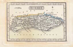
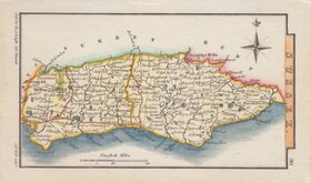
Sussex Maps
( Page 2 of 4 )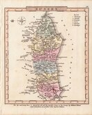
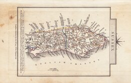
Charles Cooke 1810 [c.1824]
James Wallis 1812
Robert Miller 1819 [1821]
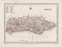
Sidney Hall 1820 [1834]
George & John Cary 1822
Roger Creighton 1831 [c.1842]
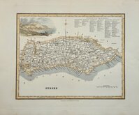
Robert Scott 1833 [c.1840]
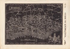
Joshua Archer 1834


22x17 cm
ORIGINAL WASH COLOUR.
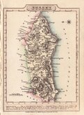
SUSSEX
Drawn & Engraved by J. Archer, Pentonville, London.
First published in Curiosities of Great Britain, England and Wales Delineated…by Thomas Dugdale by L.Tallis in 1842. The work was re-issued a number of times until 1860. The maps also appeared in The Universal English Dictionary…by the Rev. James Barclay and finally in Tallis's topographical dictionary of England & Wales in 1860.
Joshua Archer (c.1792-1863) Engraver, cartographer and copperplate printer, was born in Barnstaple in Devon. His first recorded work as an engraver was a map of Scotland for Robert Wilkinson in 1814. He was declared bankrupt in 1835, imprisoned for debt in 1845, but on the 1861 census, he is recorded as a map and chart engraver aged 69, living in Islington with his wife Jane, a son, John, also a map and chart engraver, Albert Archer, map and chart draughtsman, Albert’s wife Elizabeth and their three children. His death was recorded at Islington in the final quarter of 1763.
This example, in full original hand colour, is from the third state of the plate published in Dugdale's Curiosities 1846 & 1847.
Ref. Kingsley Printed Maps of Sussex 114(iii)
SPECIAL OFFER MOUNT OPTION AVAILABLE AT CHECKOUT FOR UK POSTAGE
Quick Links


Surrey Maps

Hampshire Maps
×