
Middlesex Maps
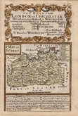
Surrey Maps
( Page 1 of 5 )
Jan Blaeu 1645
Richard Blome 1673
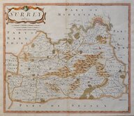
Robert Morden 1695 [1722]

Robert Morden 1695 [1722]
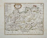
Robert Morden 1701 [c.1708]
Emanuel Bowen 1720
Thomas Read 1744 [1753]
Emanuel Bowen 1756


32x26 cm
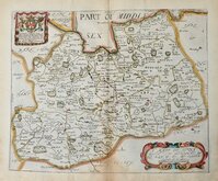
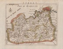
BLOME'S LARGE SERIES
A MAPP OF SURREY WITH ITS HUNDREDS BY RIC: BLOME BY HIS MATYS COMAND.
Dedication: To ye Rt. Noble Christopher Duke of Albermarle, Earle of Torrington, Baron Monke of Potheridge, Beauchampe & Teys, Kt. of ye Noble order of ye Garter, & one of ye gentlemen of ye bedchamber to his Maty. &ca. This Mapp is humbly dedicated by Ric: Blome.
Produced and published by Richard Blome (1635-1705) bookseller, mapseller and publisher, printer to King William III, and cosmographer to Queen Anne, in Britannia: or, A Geographical Description of the Kingdoms of England, Scotland and Ireland...London, Printed by Tho. Rycroft for the Undertaker, Richard Blome. 1673.
This series of maps were produced quickly, following an announcement in the press by John Ogilby, of his intention to produce a new work of county maps, road maps and town plans entitled Britannia. Richard Blome shamelessly used the same title announced by John Ogilby for his work, commencing publication in 1673. Blomes maps are crudely engraved, typical of journeyman work, and mostly copied from those of John Speed, containing no new information. The printing was carried out by Thomas Roycroft, printer to King Charles II.
The publication was probably on sale for four years. There was a re-issue of 1677 made up by John Wright from remaindered sheets.
Stain to lower edge and bottom centrefold but still a good hand coloured example.
Quick Links


Kent Maps

Sussex Maps
×