
Wales Maps
Shropshire Maps
( Page 1 of 3 )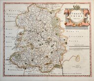
Robert Morden 1695 [1753]
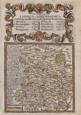
Emanuel Bowen 1720
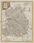
Thomas Kitchin 1763
Thomas Kitchin 1763
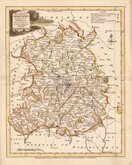
Joseph Ellis 1765 [1773]
Emanuel Bowen 1767 [1770]
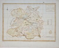
John Haywood 1788
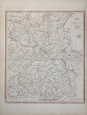
John Cary 1789 [1805]


25x20 cm
NEAT HAND COLOUR.
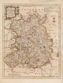
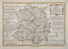
SHROPSHIRE.
Neele sc. Strand.
Published by J. Robins & Co. Albion Press London January 1.1818
Drawn and engraved by Samuel John Neele based on John Cary's 'quarto' map of 1793. The early publication of this series of maps is complex with loose issues and parts issues for many counties and publication by J & J Cundee and by J Robins & Co. the first main publication with all the county maps was The New British Traveller; or, modern panorama of England and Wales... published about 1810.
This example of the map of Shropshire has the imprint of J. Robins & Co dated 1818 and was published in Robins's Atlas of England and Wales... in 1819 and in The New British Traveller c.1820.
Small margins as usual but with complete imprint. Fine hand colour.
Quick Links


Staffordshire Maps

Herefordshire Maps
×