
Wales Maps
Shropshire Maps
( Page 1 of 3 )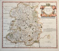
Robert Morden 1695 [1753]
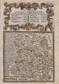
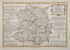
Emanuel Bowen 1720
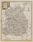
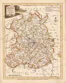
Thomas Kitchin 1763
Thomas Kitchin 1763
Joseph Ellis 1765 [1773]
Emanuel Bowen 1767 [1770]
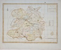
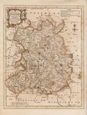
John Haywood 1788
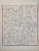
John Cary 1789 [1805]


47x34 cm
CLEAR UNCLUTTERED MAP
A MAP OF SHROPSHIRE, ENGRAVED FROM AN ACTUAL SURVEY with Improvements.
Haywood Del. | Sudlow Sc.
London. Engraved for J. Harrison, No.115, Newgate Street, as the Act directs June 17. 1788.
This series of county maps were issued at erratic intervals over a four year period bearing dates between 1787 and 1789. The atlas Maps of the English Counties… was first issued in 1791 by J. Harrison and remained on sale for several years but probably did not sell well as various price reductions are recorded.
The border is divided and numbered at 5' intervals with a graticule over the map.
A decorative map with good detail showing the roads and the hundred divisions. Folds as issued. Good margins. Good later hand colour.
Quick Links


Staffordshire Maps

Herefordshire Maps
×