
Herefordshire Maps
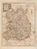
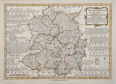
Shropshire Maps
( Page 1 of 3 )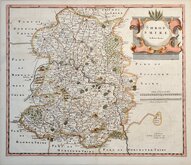
Robert Morden 1695 [1753]
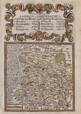
Emanuel Bowen 1720
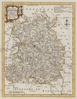
Thomas Kitchin 1763
Thomas Kitchin 1763
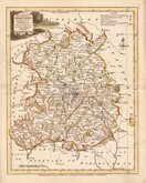
Joseph Ellis 1765 [1773]
Emanuel Bowen 1767 [1770]
John Haywood 1788
John Cary 1789 [1805]


18x24 cm
ORIGINAL WASH COLOUR.
SHROPSHIRE
Drawn and engraved by Joshua Archer for publication in Curiosities of Great Britain, England and Wales Delineated…by Thomas Dugdale.
The work was first published by L. Tallis in 1842 and was republished a number of times until 1860. The maps also appeared in The Universal English Dictionary…by the Rev. James Barclay and finally in Tallis's topographical dictionary of England & Wales in 1860.
Light offsetting and some spotting but still a good example from the 1858 edition of Dugdale's Engand and Wales Delineated in original wash hand colour.
Quick Links


Staffordshire Maps

Wales Maps
×