
Staffordshire Maps
Shropshire Maps
( Page 1 of 3 )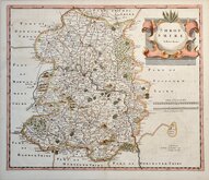
Robert Morden 1695 [1753]
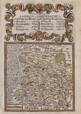
Emanuel Bowen 1720
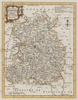
Thomas Kitchin 1763
Thomas Kitchin 1763
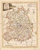
Joseph Ellis 1765 [1773]
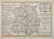
Emanuel Bowen 1767 [1770]
John Haywood 1788
John Cary 1789 [1805]


22x28 cm
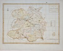
EARLY COLOUR PRINTING.
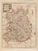
SHROPSHIRE
F.S.Weller F.R.G.S.
WILLIAM MACKENZIE. LONDON, EDINBURGH & GLASGOW.
Lithograph printed map from an engraving by Francis Sidney Weller (1849-1910), son of mapmaker Edward Weller (1819-1884), published by William Mackenzie in The Comprehensive Gazetteer of England and Wales issued in parts from c.1891-1895. The plate from which the lithograph was taken was never used for direct intaglio printing. The map is based on the New Series One Inch Ordnance Survey and has been overprinted in colours showing the county divided into administrative units.
Archival repair tape to back of short splits at centrefold just into printed area.
Quick Links


Herefordshire Maps

Wales Maps
×