
Folding Maps
Regional Maps of England & Wales
( Page 4 of 10 )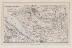
Liverpool Mersey & Dee 1858
Edward Weller NE England 1859
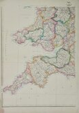
Edward Weller SW England & Wales 1859
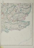
Edward Weller SE England 1859
Northern England. William Hughes 1864 [1883]
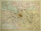
Environs of Glasgow 1867
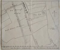
Six Hills Stevenage Herts 1880
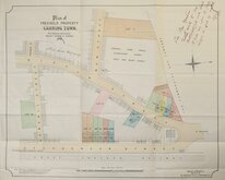
Canning Town Blackheath 1892

£10 Edward Weller SW England & Wales
Ref: 5016G
Add to
basket
Thanks,Your Product Has Been Added To Basket

32x45 cm
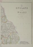
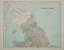
SOUTH WEST SHEET OF DISPATCH NEWSPAPER MAP OF ENGLAND AND WALES
E.Weller, Lithogr. THE DISPATCH ATLAS
ENGLAND AND WALES, SOUTH WEST SHEET
Weekly Dispatch Atlas, 139, Feet Street.
First published in the Sunday supplement to the Weekly Dispatch Newspaper Sept. 18th 1859, the map of England and Wales was printed by lithographic transfer on four separate sheets from engraved plates by Edward Weller F.R.G.S. (1819-1884), one of the pioneers of lithograph printed maps.
When the series of county maps was complete, they were published in in The Dispatch Atlas in 1863. Publishers Cassell Petter and Galpin acquired the plates and published them in Cassell's Illustrated family paper and Cassell's British Atlas in 1867, By 1869, the firm of G.W.Bacon had acquired the plates issuing them under a number of titles for over forty years.
South West sheet with part blind stamp for the Sunday supplement lower left corner. Fine original colour.
Quick Links


Road Maps

Town Plans
×