
Folding Maps
Regional Maps of England & Wales
( Page 1 of 10 )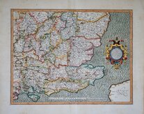
Gerard Mercator South East England 1630
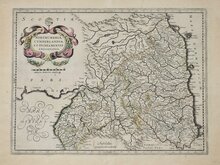
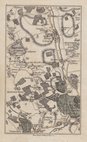
Cumberland Northumberland Durham 1639
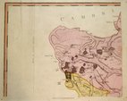
Essex Part Chapman and Andre 1777
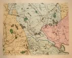
Essex Part Chapman and Andre 1777
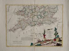
Southern Britain Zatta 1778
Kings Langley 1786
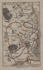
Barnet 1786
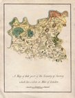
Cadell & Davies 1791


24x15 cm
ENVIRONS OF LIVERPOOL
AND THE ESTUARIES OF THE MERSEY & DEE.
Drawn by J Bartholomew J.r F.R.G.S. | Engraved by J. Bartholomew Edin.r
A.Fullarton & Co. London & Edinburgh.
Lithograph with original hand colour published in The Imperial Gazetteer of England and Wales...A. Fullarton & Co. London & Edinburgh 1858.
Toning from an old mount outside the printed area and two glue spots to upper corners verso, otherwise good.
Quick Links


Road Maps

Town Plans
×