
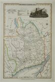
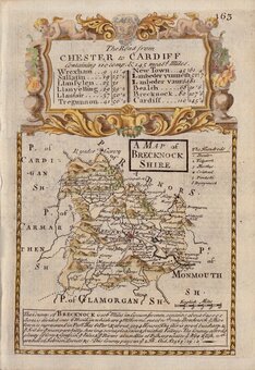
Brecknockshire
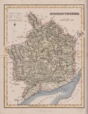
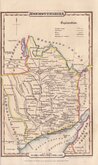
Monmouthshire
( Page 2 of 3 )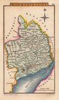
Sidney Hall 1820
John Cary 1822
Roger Creighton 1831
Gray & Son 1833
Gray & Son. 1833
Joshua Archer 1833
James Pigot 1839
James Pigot 1839


9x13 cm
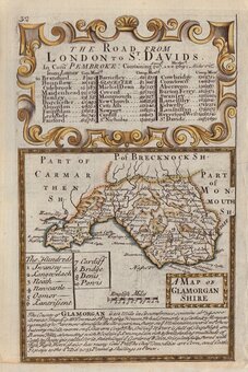
MONMOUTHSHIRE.
The engraver or engravers of this series of maps are unknown. Robert Butters, a Fleet Street printer, issued them in An Atlas of England... in 1803. They are known as the "upside-down series" as many of the maps are engraved with North to the bottom of the page. In fact, the county maps are variously orientated with North to the top, left, right or bottom of the page. The work was possibly intended for school use and the odd orientation of the maps may have been done to appeal to young minds. This represented Robert Butters' only serious venture into cartography but unlike the huge success of John Cary's publication The Traveller's Companion, on which these maps were based, Butter's publication was limited to this single issue. John Hatchard acquired the plates later the same year issuing them in a two-volume work, The Picture of England 1803 and 1804. The publications were small and surviving examples are rare.
This map, in the tradition of the ‘upside-down’ series, is orientated with North to the bottom of the page.
A good example from the first edition in original hand colour.
Quick Links

Herefordshire Maps
Glamorganshire
×