
Herefordshire Maps
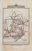
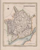
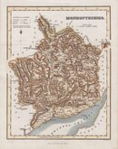
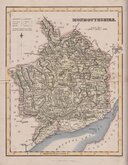
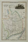
Monmouthshire
( Page 2 of 3 )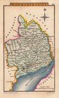
Sidney Hall 1820
John Cary 1822
Roger Creighton 1831
Gray & Son 1833
Gray & Son. 1833
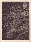
Joshua Archer 1833
James Pigot 1839
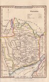
James Pigot 1839


17x23 cm
MONMOUTH | SHIRE
London, W Edwards, Ave Maria Lane.
J Archer sc. 100 Drummond Str. Euston Sq.
(In top margin outside image above): No. LXVI.] GUIDE TO KNOWLEDGE. PRICE ONE PENNY.
(In side margin outside image above): London:-Printed by R.CLAY, Bread-street-hill, Cheapside.
Woodblock engraved map by Joshua Archer. The woodblock was inked with a roller without working the ink into the engraved cuts thereby printing with a white line on a black ground. Published in parts by W. Edwards in The Guide to Knowledge edited by W Pinnock in 1833. The printing method was not popular for topographic maps and was not used again for English county maps. The woodblocks were later published by Thomas Johnson printed more conventionally by lithographic transfer in his rare publication Johnson's Atlas of England in 1847 & 1863.
Stitch holes left margin but a good example - unusual with printer's imprint.
Quick Links

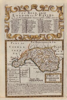
Glamorganshire
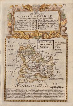
Brecknockshire
×