
Herefordshire Maps
Monmouthshire
( Page 2 of 3 )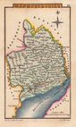
Sidney Hall 1820
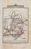
John Cary 1822
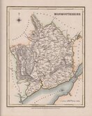
Roger Creighton 1831
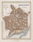
Gray & Son 1833
Gray & Son. 1833
Joshua Archer 1833
James Pigot 1839
James Pigot 1839


20x25 cm
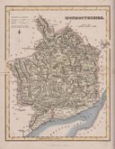
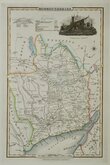
MONMOUTHSHIRE
ENGRAVED BY SIDY.HALL.
London, Published by Chapman & Hall, 193 Piccadilly.
Engraved by Sidney Hall (fl.1818-1860), this series of maps first appeared in Gorton's Topographical Dictionary issued in parts over a three year period from 1830, the complete work not published again after 1833. The maps were then issued in A New British Atlas…, Sidney Hall's British Atlas…, A Travelling County Atlas… and other variations on the title, published by Chapman and Hall from 1834 until c.1888. It's popularity due in part to regular updates to the plates to include the latest railway developments. The maps were intaglio printed until c.1858 and then by lithographic transfer. The engraver, Sidney Hall is no relation to the joint founder William Hall (with Edward Chapman) of the publishing firm Chapman and Hall, well known as publishers of the works of Charles Dickens.
This intaglio printed example, with Chapman & Hall’s Piccadilly address was published from 1852 to 1857.
Quick Links

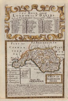
Glamorganshire
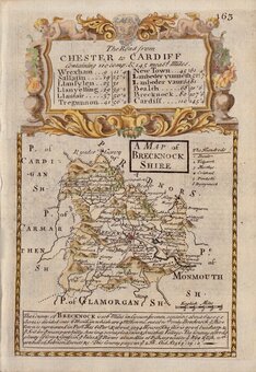
Brecknockshire
×