
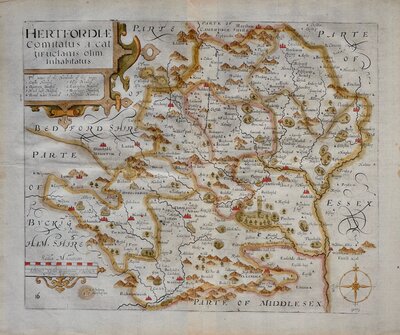
Hertfordshire Maps
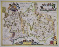
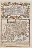
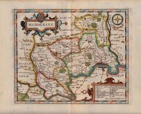
Middlesex Maps
( Page 1 of 5 )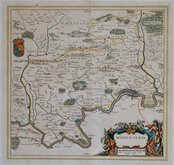
Jan Blaeu 1645

Jan Jansson 1646
Jan Jansson 1646

Jan Jansson 1681
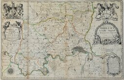
John Seller & John Oliver 1714
Emanuel Bowen 1720
John Senex 1724
Herman Moll 1724


21x17 cm
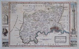
(Top of page and right of map in typeset text:
1832.] GUIDE TO KNOWLEDGE. 205
MIDDLESEX.
Reference to Hundreds and Boroughs below.)
MIDDLESEX.
Engraved by S. Hall. | Pubd. by J.Gilbert, Regent Strt.
Woodblock engraved map by Sidney Hall. The engraved woodblock was inked with a roller without working the ink into the engraved cuts thereby printing with a white line on a black ground. Published in weekly parts in The Guide to Knowledge edited by W Pinnock. The guide was re-issued in 1838 and some of the maps appeared in 1844 in (an incomplete) Descriptive county atlas of England and Wales by Groombridge Shepherd & Sutton in a revised state with a decorative border using coloured inks. The printing method was not popular for topographic maps and was not used again for English county maps. The final use of these maps was by Thomas Johnson printed more conventionally by lithographic transfer (from the Groombridge revised woodblocks) in his rare publication Johnson's Atlas of England in 1847 & 1863.
Arms of Westminster top left.
Quick Links
Central London

Environs of London
×