
Central London
Middlesex Maps
( Page 1 of 5 )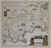
Jan Blaeu 1645

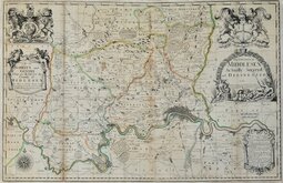
Jan Jansson 1646

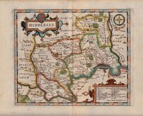
Jan Jansson 1646 [1714]
John Seller & John Oliver 1679 [1714]
John Seller 1694 [c.1784]
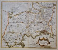
Robert Morden 1695 [1753]
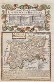
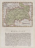
Emanuel Bowen 1720
John Senex 1724


12x18 cm
A MAP OF | MIDDLESEX
Map set below a decorative cartouche containing the title and details of the road from London to Bristol.
Road map of the final part of the route from London to Berwick verso.
Engraved text descriptions below the county map and alongside and below the road map verso.
Engraved by Emanuel Bowen (1693?-1767) and published in the pocket road book Britannia Depicta by Thomas Bowles from 1720 to 1764. The county maps were based on Robert Morden's small series published in The New Description and State of England... from 1701.
Good example in fine hand colour both sides.
(For full description of the road, go to category: Maps > British Isles > RoadMaps > Owen & Bowen.)
Quick Links


Environs of London

Hertfordshire Maps
×