
Central London
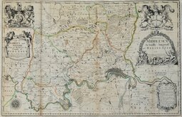
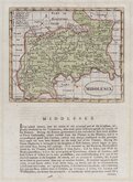
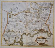
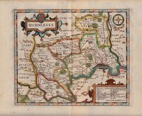
Middlesex Maps
( Page 1 of 5 )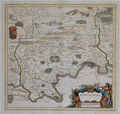
Jan Blaeu 1645

Jan Jansson 1646

Jan Jansson 1646 [1714]
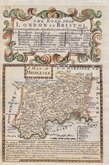
John Seller & John Oliver 1679 [1714]
John Seller 1694 [c.1784]
Robert Morden 1695 [1753]
Emanuel Bowen 1720
John Senex 1724


£1000 John Seller & John Oliver
Ref: 6110vG
Add to
basket
Thanks,Your Product Has Been Added To Basket

91x59 cm
LARGE RARE MAP ON TWO SHEETS JOINED.
The COUNTY of MIDDLESEX actually Survey'd and DELINEATED AND Newly Corrected & Amended with many Additions. Note that ye uppermost Figures in ye Circles are Computed and the undermost Staute or Measured Miles. A.D. 1714.
To the NOBILITY and GENTRY That are Related to the County of MIDLESEX This MAP is humbly dedicated and Sold by Jos. Smith at ye West end within Exeter Exchange in the Strand.
I. Oliver sculp.
John Seller's rare map of Middlesex engraved by John Oliver first issued by John Seller (fl. 1660-1697), hydrographer to Charles II, James II and Queen Anne, in 1679. The map was intended to be part of a large folio atlas of England and Wales but despite financial support from the treasury, the scheme failed with only the the six counties of Middlesex, Hertfordshire, Kent, Surrey, Buckinghamshire and Oxfordshire completed. Seller sold the plates to Philip Lea who issue them in composite atlases and loose sheet maps. Philip Lea died in 1700 and his business was continued by his widow, Anne lea until her death in 1730.
John Seller's name in the dedication has been changed to Jos. Smith who was possibly a co-publisher with Anne Lea or had acquired the plate by 1714.
The engraver and partner in the aborted scheme was John Oliver (1616?-1701), builder, architect, glass-painter, mapmaker, surveyor, printseller, publisher, and engraver. Oliver was a common councilman for Queenhithe Ward 1667-1689, was appointed official surveyor to the City of London in 1668, and married his second wife Susanna Speed, grand-daughter of the map-maker John Speed, in 1670. He was master of the Glaziers company 1685-6 and became Master Mason to the King in 1686.
Engraved on two sheets joined, the map is in original outline hand colour. A horizontal and two additional vertical folds with a few repairs at the folds verso. The map has been trimmed to the engraved line, now re-margined. A light sellotape stain to map at Harrow Weald and repair to sellotape stain at bottom margin near Sidcup. Despite these faults it remains a good impression of a large and attractive and rare map.
Quick Links


Hertfordshire Maps

Environs of London
×