
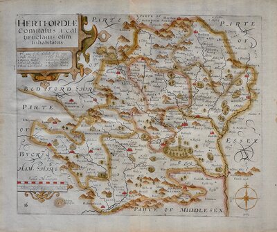
Hertfordshire Maps
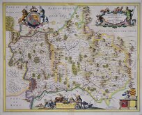
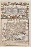
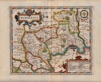
Middlesex Maps
( Page 1 of 5 )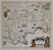
Jan Blaeu 1645

Jan Jansson 1646
Jan Jansson 1646

Jan Jansson 1681
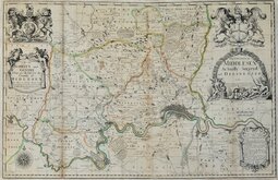
John Seller & John Oliver 1714
Emanuel Bowen 1720
John Senex 1724
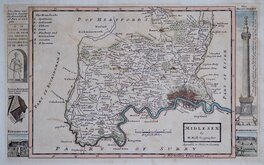
Herman Moll 1724


32x20 cm
MIDLESEX | By | H.Moll Geographer. | Agreable to Modern History
Copperplate engraving by Herman Moll, first published in his New Description of England and Wales…in 1724. Moll's own description of his work read: to render this work more acceptable to the curious, the margins of each map are adorn'd with a great variety of very remarkable antiquities. Probably born in Bremen, Germany about 1654, Moll came to London about 1688 and set up business in Blackfriars as an engraver and map seller. His interest in antiquities is further evidenced by his association with the antiquary Dr. William Stukeley to whom he dedicated his work Geographia Antiqua in 1721. His New Description… was not popular, appearing in only a single edition but the maps were also issued with greater success without the text description in his Set of fifty New and Correct maps of England and Wales and other titles in the same format. There were several re-issues, with maps unchanged except for the addition of a plate number, by various publishers between 1724 and 1747. Herman Moll died in St. Clement Danes, September 22nd 1732. The final appearance was in 1753 with the plates cut down to remove the antiquities published by Thomas Bowles and J Bowles and Son.
Despite this extended publication period the maps are now uncommon. This example of the map of Middlesex in fine hand colour is the second state of the plate with the plate number (19) added in top left border published between 1724 and 1739. With vignettes of The Fire Monument, Hampton Court, Kensington Palace and Roman antiquities in the margins. Archival tape repairs to short marginal nicks not affecting plate area. Light toning but still a good example in good later hand colour.
Quick Links

Environs of London
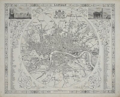
Central London
×