
Central London
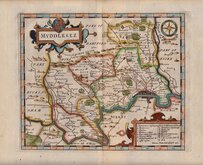
Middlesex Maps
( Page 1 of 5 )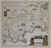
Jan Blaeu 1645

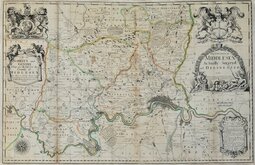
Jan Jansson 1646

Jan Jansson 1646 [1714]
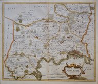
John Seller & John Oliver 1679 [1714]
John Seller 1694 [c.1784]
Robert Morden 1695 [1753]
Emanuel Bowen 1720
John Senex 1724


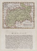
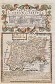
9x13 cm
RARE "UPSIDE-DOWN" SERIES.
MIDDLESEX.
The engraver or engravers of this series of maps are unknown and the maps are known by the first publisher, Robert Butters, a Fleet Street printer, who issued them in An Atlas of England... in 1803. They are also referred to as the "upside-down series" as the England map and many of the county maps are engraved with North to the bottom of the page. In fact, the county maps are variously orientated with North to the top, left, right or bottom of the page. The work was possibly intended for school use and the odd orientation of the maps may have been done to appeal to young minds. This was Robert Butters' only serious venture into cartography, but unlike the huge success of John Cary's publication The Traveller's Companion, on which these maps were based, Butter's publication was limited to this single issue. John Hatchard acquired the plates later the same year issuing them in a two-volume work The Picture of Englan...by William Green...1803, and 1804. Most maps were unchanged in these Hatchard editions but those county maps engraved to read in landscape format had the titles re-engraved sideways to appear consistent in the portrait format of the work. The publications were small and surviving examples are very rare.
North is to the right.
Some light spotting but a rare map in original hand colour.
Quick Links


Hertfordshire Maps

Environs of London
×