
Northamptonshire Maps
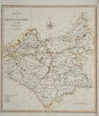
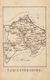
Leicestershire Maps
( Page 1 of 3 )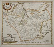
Robert Morden 1695 [1753]
Emanuel Bowen 1720
Joseph Ellis 1765 [1773]
John Haywood 1787 [1791]
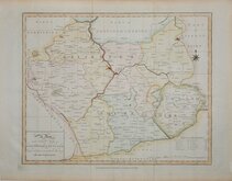
John Cary 1787 [1793]
John Cary 1789 [1805]
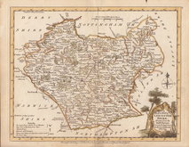
Robert Butters 1803
John Cary 1808 [1809]


25x20 cm
ORIGINAL HAND COLOUR.
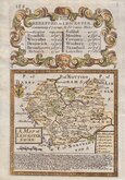
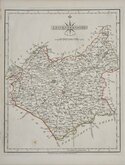
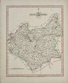
LEICESTERSHIRE.
ENGRAVED BY SIDY. HALL.
This series of maps first appeared in Gorton's Topographical Dictionary issued in parts over a three year period from 1830, the complete work not published again after 1833. The maps were then issued in A New British Atlas…, Sidney Hall's British Atlas…, A Travelling County Atlas… and other variations on the title, from 1834 until c.1888. It's popularity due in part to the continuous updating of the plates to include the latest railways. The maps were intaglio printed until c.1858 and then by lithographic transfer.
This example, in original outline hand colour, is from the 1852 edition entitled A Travelling County Atlas: with All the Railroads Accurately Laid Down and Coloured published by Chapman and Hall, 193 Piccadilly. (Late 186 Strand.)
Quick Links


Warwickshire Maps

Staffordshire Maps
×