
Surrey Maps
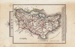
Kent Maps
( Page 2 of 3 )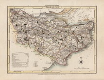
Cole & Roper 1806
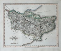
Nathaniel Coltman 1806 [1809]
Cole & Roper 1806 [1810]
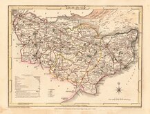
John Cary 1808 [1809]
Sidney Hall 1820
John Cary 1822
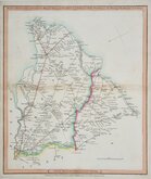
Samuel Tymms 1822 [1832]
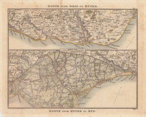
Dover & Romney 1826


23x18 cm
FIRST EDITION. ORIGINAL HAND COLOUR.
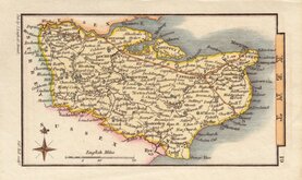
KENT
Drawn and Engraved under the direction of E.W.Brayley.
Engraved by John Roper, from a Drawing by G.Cole; to accompany the beauties of England and Wales.
London Published by Vernor, Hood & Sharpe, Poultry; Decr. 1st 1806.
Engraved by John Roper (1771-1810), a London engraver and copperplate printer trading from New Street Square from 1797 until his death in 1810. His widow, Mary Roper, continued the business at the same address until at least 1846. This series of maps, most drawn by George Cole, were intended to accompany The Beauties of England and Wales. The maps were not actually published with this work but first issued in parts as a separate series between 1804 and 1810 and first appearing in atlas form in The British Atlas published by Vernor Hood & Sharpe (& nine other publishers) in 1810. The maps were re-issued in several publications including Dugdale's Curiosities of Great Britain until 1843. Their final appearance was by lithographic transfer in Collins' railway and pedestrian atlas… published by Darton and Co. in 1858.
This fine example of the map of Kent is the first state of the plate in fine original hand colour with the imprint of the publishers Vernor Hood & Sharpe dated 1806 and the note that it was to accompany the publication The Beauties of England and Wales. The paper is rough cut on the leading edge and has stitch holes on the binding edge suggesting that it is from the pre-atlas parts issue of 1806.
Quick Links


Sussex Maps

Essex Maps
×