
Hampshire Maps
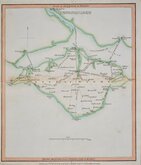
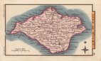
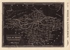
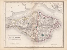
Isle of Wight
( Page 1 of 2 )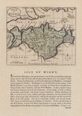
John Seller 1694 [1784]
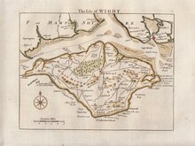
Thomas Read 1746 [1769]
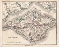
John Cary 1798 [1821]
George Cole 1805
Nathaniel Coltman 1806 [1809]
Sidney Hall 1820
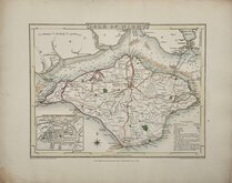
Joshua Archer 1833
Selina Hall 1833 [c.1852]


24x18 cm
ORIGINAL OUTLINE AND WASH COLOUR.
ISLE OF WIGHT.
Drawn & Engraved by J. Archer, Pentonville, London.
First published in Curiosities of Great Britain, England and Wales Delineated…by Thomas Dugdale by L.Tallis in 1842. The work was re-issued a number of times until 1860. The maps also appeared in The Universal English Dictionary…by the Rev. James Barclay and finally in Tallis's topographical dictionary of England & Wales in 1860.
Joshua Archer (c.1792-1863), Engraver, cartographer and copperplate printer, was born in Barnstaple in Devon. His first recorded work as an engraver was a map of Scotland for Robert Wilkinson in 1814. He was declared bankrupt in 1835, imprisoned for debt in 1845 but recorded as a map and chart engraver aged 69, on the 1861 census, living in Islington with his wife, Jane, a son, John, also a map and chart engraver, Albert Archer, (map and chart draughtsman) and his wife Elizabeth and three children.
Slight mark over title otherwise good in original hand colour from a post 1846 edition.
Quick Links


Dorset Maps

Wiltshire Maps
×