
Hampshire Maps
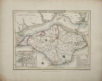
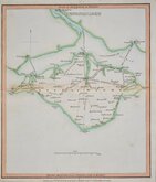
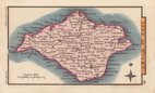
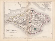
Isle of Wight
( Page 1 of 2 )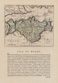
John Seller 1694 [1784]
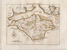
Thomas Read 1746 [1769]
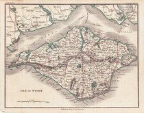
John Cary 1798 [1821]
George Cole 1805
Nathaniel Coltman 1806 [1809]
Sidney Hall 1820
Joshua Archer 1833
Selina Hall 1833 [c.1852]


23x16 cm
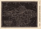
WOODBLOCK ENGRAVING ALSO KNOWN AS "PINNOCK" MAPS
No. LIX.] GUIDE TO KNOWLEDGE. PRICE ONE PENNY
ISLE OF WIGHT
London Edwards 12 Ave Maria Lane
Unsigned woodblock engraving published in weekly parts in The Guide to Knowledge edited by W. Pinnock...London: W.Edwards 1833-34.
Joshua Archer (1792?-1863) and Selina Hall (1708?-1853) were engravers employed for other county maps in the series.
William Pinnock (1782-1843), born in Alton, Hampshire became a schoolmaster. In 1817 he moved to London and, in partnership with Samuel Maunder, began the publication of cheap educational works. The Guide to Knowledge was a publication issued in weekly parts between 1833 and 1834 and containing maps printed from the woodblock with the incised lines appearing white on a black ground. The technique proved unpopular for topographical maps and was not used again, the county maps appearing later in a more traditional format by lithographic transfer Johnson's Atlas of England in 1847 & 1863.
The engraver was Joshua Archer (c.1792-1863), engraver, cartographer and copperplate printer, born in Barnstaple in Devon. His first recorded work as an engraver was a map of Scotland for Robert Wilkinson in 1814. He was declared bankrupt in 1835, imprisoned for debt in 1845 but recorded as a map and chart engraver aged 69, on the 1861 census, living in Islington with his wife, Jane, a son, John, also a map and chart engraver, Albert Archer, a map and chart draughtsman, his wife Elizabeth and three children.
Very good example from the first issue.
Quick Links


Dorset Maps

Wiltshire Maps
×