
Wiltshire Maps
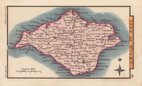
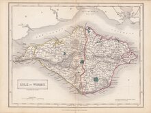
Isle of Wight
( Page 1 of 2 )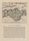
John Seller 1694 [1784]
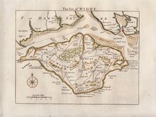
Thomas Read 1746 [1769]
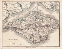
John Cary 1798 [1821]
George Cole 1805
Nathaniel Coltman 1806 [1809]
Sidney Hall 1820
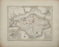
Joshua Archer 1833
Selina Hall 1833 [c.1852]


24x18 cm
ORIGINAL WASH COLOUR.
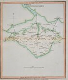
ISLE OF WIGHT.
Drawn & Engraved by J. Archer, Pentonville, London.
First published in Curiosities of Great Britain, England and Wales Delineated…by Thomas Dugdale by L.Tallis in 1842. The work was re-issued a number of times until 1860. The maps also appeared in The Universal English Dictionary…by the Rev. James Barclay and finally in Tallis's topographical dictionary of England & Wales in 1860.
Joshua Archer (c.1792-1863), Engraver, cartographer and copperplate printer, was born in Barnstaple in Devon. His first recorded work as an engraver was a map of Scotland for Robert Wilkinson in 1814. He was declared bankrupt in 1835, imprisoned for debt in 1845 but recorded as a map and chart engraver aged 69, on the 1861 census, living in Islington with his wife, Jane, a son, John, also a map and chart engraver, Albert Archer, (map and chart draughtsman) and his wife Elizabeth and three children.
This map of the Isle of Wight is from the 1846 edition of Dugdales Curiosities. Good example in original wash hand colour.
Quick Links


Dorset Maps

Hampshire Maps
×