
Europe
Historical Maps
( Page 1 of 10 )
Saxon Heptarchy Robert Morden 1695

Roman Britain Robert Morden 1695
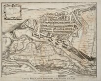
Cuneo Piedmont Savoy 1727
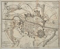
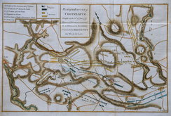
Siege of Tournai 1727
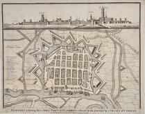
Nieuwpoort Belgium 1727
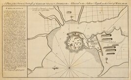
Vijaydurg Fort 1756
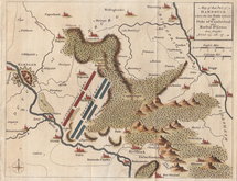
Battle of Hastenbeck 1757
Battle of Kolin 1757


60x84 cm
MAP OF BRITAIN IN THE DARK AGES South Sheet SCALE: 1:1,000,000
Published by the Director-General, ORDNANCE SURVEY, SOUTHAMPTON 1939.
Card covers 16x23cm. Title | 2pp. Foreword.| 8pp. Description | Key Plan of Place Names in -ing | Key Plan of Cemeteries | 23pp Index.| Linen backed fold-out map of BRITAIN IN THE DARK AGES (SOUTH SHEET).
Minor chips and dents to card covers. Chips and breaks to spine. Map with minor diagonal crease to bottom left corner otherwise near perfect.
Quick Links


Mediterranean

Road Maps
×