
Road Maps
Historical Maps
( Page 2 of 10 )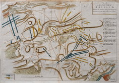
Battle of Rossbach 1757
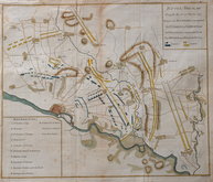
Battle of Breslau 1757
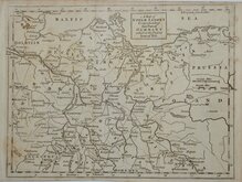
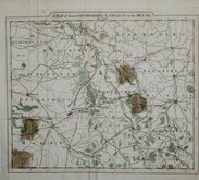
Seven Years War Upper Saxony 1757
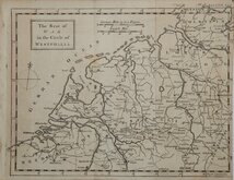
Seven Years War Westphalia 1757
Vanuatu & New Caledonia Cook 1776
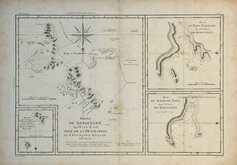
Kerguelen Islands, Desolation Islands 1788
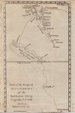
Dumourier's Campaign on the Meuse 1793
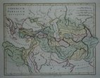
Persian Empire 1798


60x84 cm
MAP OF BRITAIN IN THE DARK AGES South Sheet SCALE: 1:1,000,000
Published by the Director-General, ORDNANCE SURVEY, SOUTHAMPTON 1939.
Card covers 16x23cm. Title | 2pp. Foreword.| 8pp. Description | Key Plan of Place Names in -ing | Key Plan of Cemeteries | 23pp Index.| Linen backed fold-out map of BRITAIN IN THE DARK AGES (SOUTH SHEET).
Minor chips and dents to card covers. Chips and breaks to spine. Map with minor diagonal crease to bottom left corner otherwise near perfect.
Quick Links


Europe

Mediterranean
×