
Hertfordshire Prints
Hertfordshire Maps
( Page 11 of 11 )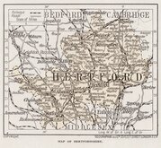
Geographia 1924
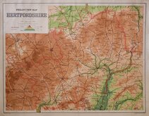
George Philip & Son. 1950
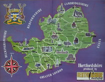
John Martindale 1973
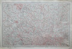
Bartholomew Post Code Map 1974
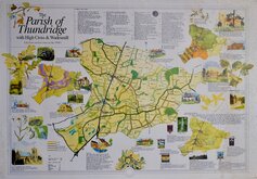
Parish of Thundridge 1992


13x11 cm
SMALL COLOUR PRINTED MAP
HERTFORD (Title over map)
MAP OF HERTFORDSHIRE.
GEOGRAPHICA (1923) L.TD 55 FLEET STREET LONDON E.C.4.
Printed within text in Britain Beautiful Hutchinson & Co., Paternoster Row. published from 1924.
Geographia, map publisher from 1911 until 1987, traded as "Geographia (1923) Ltd." between 1923 and 1925.
Quick Links


Essex Maps

Middlesex Maps
×