
Middlesex Maps
Hertfordshire Maps
( Page 10 of 11 )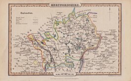
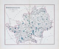
James Pigot & Isaac Slater 1839 [c.1841]
James Pigot & Isaac Slater 1839 [c.1841]
Joshua Archer 1842 [1860]
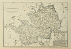
Benjamin Rees Davies 1860
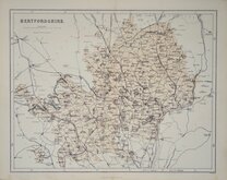
Edward Weller 1864 [1870]
Benjamin Rees Davies 1867
William Hughes 1868
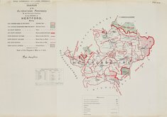
Boundaries Commission 1888

£45 James Pigot & Isaac Slater
Ref: 3676wb
Add to
basket
Thanks,Your Product Has Been Added To Basket

16x11 cm
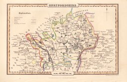
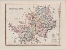
MINIATURE PIGOT WITH ORIGINAL TEXT, DISTANCE TABLE AND VIGNETTE OF ST ALBANS ABBEY.
HERTFORDSHIRE.
Pigot & Slater Engravers Manchr.
PUBLISHED BY PIGOT & Co. LONDON AND MANCHESTER.
Lithographic transfer produced by Pigot and Slater for publication in Pigot & Co.'s pocket atlas, topography and gazetteer of England…London and Manchester J. Pigot & Co. 1839. The work was issued twice more in 1841 and 1850 and individual county sections were probably issued separately. James Pigot (1769-1843) is well known for his steel engraved county maps and his directories published from 1826 and this series of lithograph printed maps were based on his steel engraved series, but this miniature work did not achieve the success of his earlier publications and the maps are uncommon today.
With a full stop after the engraver's signature, this example is the second state of the plate published in 1841 and 1850.
Good example of an uncommon map in original hand colour. Includes original text pages with vignette of St. Albans Abbey, distances tables and 24 pages of description of the county.
Ref. Hodson Printed Maps of Hertfordshire 104B
Quick Links


Essex Maps

Hertfordshire Prints
×