
Worcestershire Maps
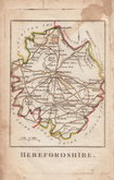
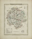
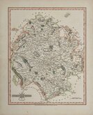
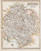
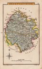
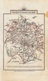
Herefordshire Maps
( Page 2 of 3 )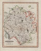
Benjamin Baker 1793
Robert Butters 1803
George Cole 1805
John Cary 1809
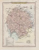
George Cole 1810 [c.1838]
Samuel John Neele 1818 [1819]
Sidney Hall 1820
John Cary 1822


12x18 cm
"OWEN & BOWEN"
A MAP of HEREFORD SHIRE
Map set below a decorative cartouche containing the title and details of the road from Bristol to Chester.
Road map of the first part of the route from Bristol to Chester verso.
Engraved text descriptions below the county map and alongside and below the road map verso.
Engraved by Emanuel Bowen (1693?-1767) and published in the pocket road book Britannia Depicta by Thomas Bowles from 1720 to 1764. The county maps were based on Robert Morden's small series published in The New Description and State of England... from 1701. Text descriptions compiled by John Owen.
Good early impression.
For full description of the road, go to category: Maps > British Isles > RoadMaps > Owen & Bowen.
Quick Links


Wales Maps

Gloucestershire Maps
×