
Berkshire Maps
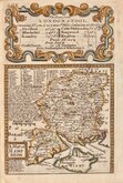
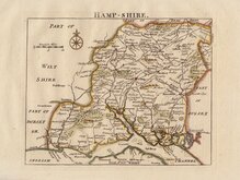
Hampshire Maps
( Page 1 of 3 )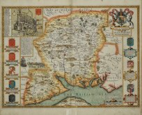
John Speed 1611
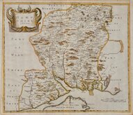
Robert Morden 1695
Emanuel Bowen 1720
Thomas Read 1744 [1769]
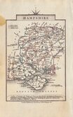
John Haywood 1791
George Cole 1810
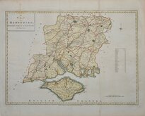
Sidney Hall 1820 [1834]
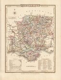
George & John Cary 1822


23x29 cm
ORIGINAL COLOUR SHOWING POOR LAW UNION DIVISIONS
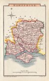
SOUTHAMPTON
Drawn by R.Creighton. | Engraved by J.& C. Walker.
DRAWN AND ENGRAVED FOR LEWIS' TOPOGRAPHICAL DICTIONARY.
Copper engraving by brothers John Walker (1790?-1873) and Charles Walker (1799?-1872) trading as “J & C Walker” from about 1827. John Walker is known for his work for James Horsburgh and the East India Company as well as his work for the Admiralty and leading publishers of the period. He was founder member of the Royal Geographical Society in 1830. The map was drawn by Roger Creighton and published in A Topographical Dictionary of England…Samuel Lewis and Co. from 1831. The work achieved considerable success and was re-issued many times by Lewis until 1849. During this time the maps were regularly updated to include parliamentary and electoral information and changes to the rapidly expanding railway network.
This map of Hampshire and the Isle of Wight includes the addition of the Poor Law Unions published in 1844.
Some minor creasing top and bottom otherwise a good clean example in original outline hand colour depicting the new Union boundaries.
Quick Links

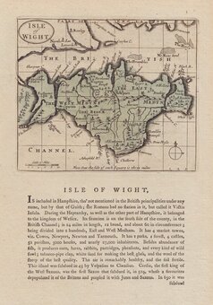
Isle of Wight

Wiltshire Maps
×