
Somerset Maps
Gloucestershire Maps
( Page 2 of 3 )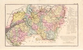
Henry Cooper 1808
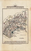
John Cary 1809
George Cole 1810
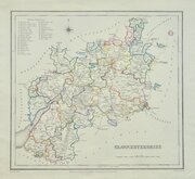
Sidney Hall 1820
John Cary 1822
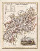
Roger Creighton 1831 [1844]
Gray & Son 1833
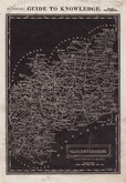
Joshua Archer 1833


22x27 cm
"QUARTO" CARY. INCLUDES TEXT PAGES. FINE ORIGINAL COLOUR.
GLOCESTERSHIRE
London: Published July 1. 1809 by J.Cary, Engraver & Map seller Strand.
Copper engraving by John Cary. This series of maps, commonly known as his "quarto" series, were published in Cary's New and Correct English Atlas and were justifiably popular, running to many editions from 1787 until about 1804. Re-engraved plates extended the life of the series from 1808 to 1843 and lithographic transfers from the plates by later publishers continued publication until about 1876 - a life of nearly 90 years.
This example of the map of Gloucestershire is the first state of the re-engraved plate published in Cary's New and Correct English Atlas of 1809.
Very good condition in fine original hand colour. Includes original typeset page of text description of the county.
Quick Links


Wiltshire Maps
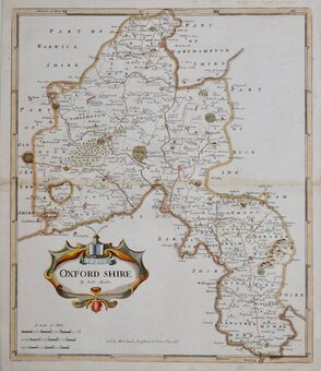
Oxfordshire Maps
×