
Somerset Maps
Gloucestershire Maps
( Page 2 of 3 )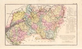
Henry Cooper 1808
John Cary 1809
George Cole 1810
Sidney Hall 1820
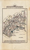
John Cary 1822
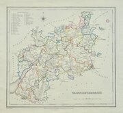
Roger Creighton 1831 [1844]
Gray & Son 1833
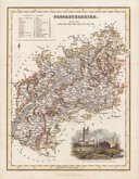
Joshua Archer 1833


18x23 cm
ORIGINAL OUTLINE HAND COLOUR TO THE HUNDREDS
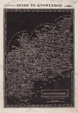
GLOUCESTERSHIRE
Drawn & Engraved by J Archer Pentonville London.
Drawn and engraved by Joshua Archer for publication in Curiosities of Great Britain, England and Wales Delineated…by Thomas Dugdale.
The work was first published by L. Tallis in 1842 and was republished a number of times until 1860. The maps also appeared in The Universal English Dictionary…by the Rev. James Barclay and finally in Tallis's topographical dictionary of England & Wales in 1860.
Good example of the map of Gloucestershire in original hand colour from the 1848 edition of Dugdale's Curiosities.
Quick Links


Wiltshire Maps
Oxfordshire Maps
×