
Nottinghamshire Maps
Derbyshire Maps
( Page 3 of 4 )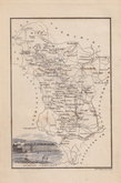
Stephen Glover 1830

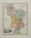
Roger Creighton 1831
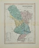
Robert Scott 1833 [1848]

James Pigot 1839
Joshua Archer 1842 [1848]
Joshua Archer 1842 [1860]

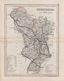
Stephen Glover 1845
Stephen Glover 1845


10x15 cm
BOUND IN THE BOOK "THE PEAK GUIDE"
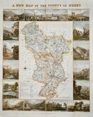
(No Title)
Josih. Neele sc. 352 Strand.
Steel engraving by Josiah Neele (1804-1876), son of Samuel John Neele 1758-1824).
Published in The Peak Guide by Stephen Glover 1830.
No title or north point. Vignette of Buxton Crescent.
This map is bound into the book and the price below is for the book complete - for more details go to our listing in Antiquarian books.
Quick Links


Leicestershire Maps

Staffordshire Maps
×