
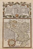
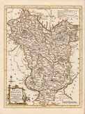
Leicestershire Maps
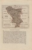
Derbyshire Maps
( Page 1 of 4 )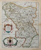
Richard Blome 1673
John Seller 1694 [1784]

Robert Morden 1695
Emanuel Bowen 1720
Thomas Kitchin 1764
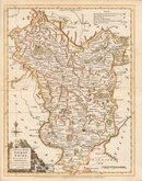
Joseph Ellis 1765 [1773]

John Haywood 1789
Benjamin Baker 1791


18x24 cm
FIRST EDITION. FINE COLOUR.
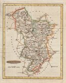
DERBYSHIRE
Drawn by R.Creighton. | Engraved by J.& C. Walker.
DRAWN AND ENGRAVED FOR LEWIS' TOPOGRAPHICAL DICTIONARY.
Copper engraving by brothers John Walker (1790?-1873) and Charles Walker (1799?-1872) trading as “J & C Walker” from about 1827. John Walker is known for his work for James Horsburgh and the East India Company as well as his work for the Admiralty and leading publishers of the period. He was founder member of the Royal Geographical Society in 1830. The map was drawn by Roger Creighton and published in A Topographical Dictionary of England…Samuel Lewis and Co. from 1831. The work achieved considerable success and was re-issued many times by Lewis until 1849. During this time the maps were regularly updated to include parliamentary and electoral information and changes to the rapidly expanding railway network.
Good example from the first edition.
Quick Links


Nottinghamshire Maps

Staffordshire Maps
×