
Europe
Channel, Scilly and other small islands.
( Page 1 of 2 )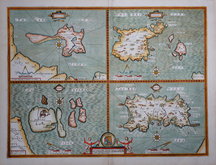
John Speed 1610 [1676]
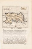
Jersey. John Seller 1694 [1787]
Robert Morden 1695 [1753]
Emanuel Bowen 1720
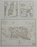
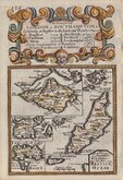
John Cary 1789 [1805]
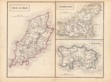
Selina Hall. 1830 [1852]
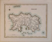
Jersey. Roger Creighton 1831
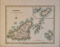
Guernsey. Roger Creighton 1831


38x50 cm
"CARY STOCKDALE"
A MAP of the ISLAND of JERSEY Drawn from the Survey of Philip Dumaresq Esq.r Seigneur of Samares.
Published by John Stockdale Picadilly 26.th March 1805
Engraved by J. Cary.
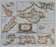
Smaller maps:
ISLE OF MAN (Title over the map.)
ALDERNEY.
GARNSEY or SABINA.
Engraved by John Cary (1755-1835) For publication in Richard Gough's translation of William Camden's Britannia in 1789. This edition published by John Stockdale in his New British Atlas in 1805.
Quick Links


British Isles

Sea Charts
×