
Europe
Channel, Scilly and other small islands.
( Page 1 of 2 )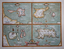
John Speed 1610 [1676]
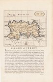
Jersey. John Seller 1694 [1787]
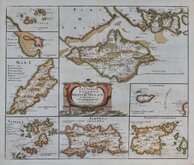
Robert Morden 1695 [1753]
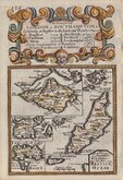
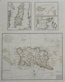
Emanuel Bowen 1720
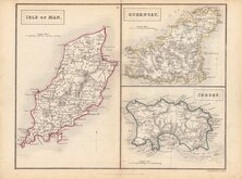
John Cary 1789 [1805]
Selina Hall. 1830 [1852]
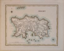
Jersey. Roger Creighton 1831
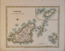
Guernsey. Roger Creighton 1831


12x18 cm
FROM THE "OWEN & BOWEN" POCKET ROAD BOOK BRITANNIA DEPICTA
The Smaller Islands in the BRITISH OCEAN
Inset maps of the Isle of Wight, Scilly Isles, Guernsey, Jersey, Alderney, Holy Island Farne Islands and Isle of Man set below title to the road from London to Southampton engraved by Emanuel Bowen (1693?-1767) and published in the pocket road book Britannia Depicta by Thomas Bowles from 1720 to 1764. The county maps were based on Robert Morden's small series published in The New Description and State of England... from 1701.
Road map Shrewsbury to Welshpool verso.
Very good in neat later hand colour.
For full description of the road, go to the listing (plate 127) under category: RoadMaps>Owen & Bowen.
For more information on Britannia Depicta, see the description under the category heading under Owen & Bowen.
Quick Links


Sea Charts

British Isles
×