
British Isles
Channel, Scilly and other small islands.
( Page 2 of 2 )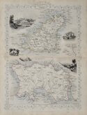
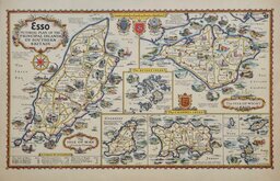
Channel Islands. John Rapkin 1851
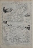
Channel Islands John Rapkin 1851
Channel Islands. John Rapkin 1851 [c.1860]
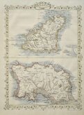
Cassell Petter & Galpin 1863 [1867]
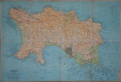
Jersey. Anonymous. 1930
Alfred Taylor 1932 [1936]
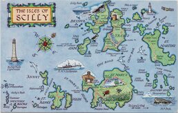
Scilly Isles Map Post Card 1970


38x50 cm
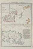
"CARY STOCKDALE"
A MAP of the ISLAND of JERSEY Drawn from the Survey of Philip Dumaresq Esq.r Seigneur of Samares.
Published by John Stockdale Picadilly 26.th March 1805
Engraved by J. Cary.
Smaller maps:
ISLE OF MAN (Title over the map.)
ALDERNEY.
GARNSEY or SABINA.
Engraved by John Cary (1755-1835) For publication in Richard Gough's translation of William Camden's Britannia in 1789. This edition published by John Stockdale in his New British Atlas in 1805.
Quick Links


Europe

Sea Charts
×