
Road Maps
Buckinghamshire Maps
( Page 1 of 4 )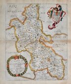
Richard Blome 1673
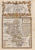
John Seller 1694 [1784]
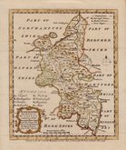
Robert Morden 1695
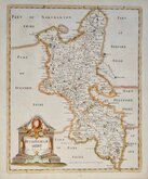
Robert Morden 1695 [1753]
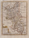
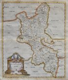
Robert Morden 1701 [c.1708]
Emanuel Bowen 1720
Emanuel Bowen 1758
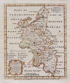
Emanuel Bowen 1758


16x20 cm
MORDEN'S SMALLER SERIES.
BUCKINGHAM SHIRE
by Rob.t Morden
I.Harris Sculp.
Robert Morden's series of smaller maps thought to have been engraved in about 1693 for Edmund Gibson's translation of Camden's Britannia but rejected for being too small. Morden published them a few years later in 1701 in his New Description and state of England . The work was re-issued twice more after his death in 1703 by Ralph Smith and others in 1704, and published in several works, most notably, Cox's Magna Britannia, often issued with spurious dates on the title page, from 1708 until the end of the 18th century. The later states can be identified by the addition of a compass rose.
The engraver, John Harris (fl.1686-1730) engraved six maps for this work and was a well respected and prolific engraver, producing maps for well known mapmakers including Philip Lea, John Senex, Christopher Browne, Benjamin Cole, Herman Moll and the antiquary William Stukeley.
Fine dark impression in the second state. Hand coloured.
Quick Links


Berkshire Maps

Bedfordshire Maps
×