
Road Maps
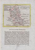
Buckinghamshire Maps
( Page 1 of 4 )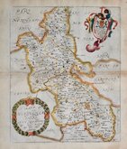
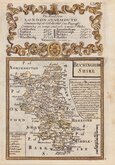
Richard Blome 1673
John Seller 1694 [1784]
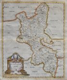
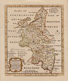
Robert Morden 1695
Robert Morden 1695 [1753]
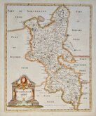
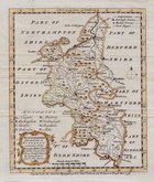
Robert Morden 1701 [c.1708]
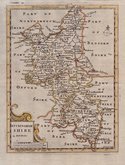
Emanuel Bowen 1720
Emanuel Bowen 1758
Emanuel Bowen 1758


12x18 cm
FROM "OWEN & BOWEN' POCKET ROAD BOOK BRITANNIA DEPICTA.
BUCKINGHAM SHIRE
Map set below a decorative cartouche containing the title and details of the road from London to Yarmouth commencing at Colchester.
Road map of the first part of the route from Colchester to Great Yarmouth verso.
Engraved text descriptions below the county map and alongside and below the road map verso.
Engraved by Emanuel Bowen (1693?-1767) and published in the pocket road book Britannia Depicta by Thomas Bowles from 1720 to 1764. The county maps were based on Robert Morden's small series published in The New Description and State of England... from 1701. Text descriptions compiled by John Owen.
Good example in fine hand colour both sides.
For full description of the road, go to category: Maps > British Isles > RoadMaps > Owen & Bowen.
Quick Links


Berkshire Maps

Bedfordshire Maps
×