
Berkshire Maps
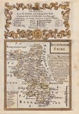
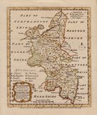
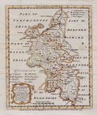
Buckinghamshire Maps
( Page 1 of 4 )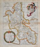
Richard Blome 1673
John Seller 1694 [1784]
Robert Morden 1695
Robert Morden 1695 [1753]
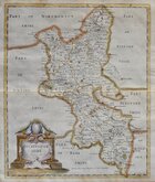
Robert Morden 1701 [c.1708]
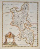
Emanuel Bowen 1720
Emanuel Bowen 1758
Emanuel Bowen 1758


9x14 cm
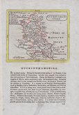
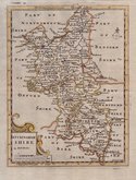
RARE "UPSIDE-DOWN" SERIES
BUCKINGHAMSHIRE.
The engraver or engravers of this series of maps are unknown. Robert Butters, a Fleet Street printer, issued them in An Atlas of England... in 1803. They are known as the "upside-down series" as many of the maps are engraved with North to the bottom of the page. In fact, the county maps are variously orientated with North to the top, left, right or bottom of the page. The work was possibly intended for school use and the odd orientation of the maps may have been done to appeal to young minds. This represented Robert Butters' only serious venture into cartography but unlike the huge success of John Cary's publication The Traveller's Companion, on which these maps were based, Butter's publication was limited to this single issue. John Hatchard acquired the plates later the same year issuing them in a two-volume work, The Picture of England 1803 and 1804. The publications were small and surviving examples are rare.
In the true tradition of the series, though it lacks a compass indicator, Buckinghamshire is engraved with North to the bottom of the page.
Some minor discolouration to paper edges but with good margins, a good example in original hand colour from the first issue by Robert Butters.
Quick Links


Bedfordshire Maps

Road Maps
×