
Berkshire Maps
Buckinghamshire Maps
( Page 1 of 4 )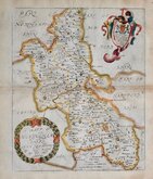
Richard Blome 1673
John Seller 1694 [1784]
Robert Morden 1695
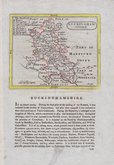
Robert Morden 1695 [1753]
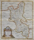
Robert Morden 1701 [c.1708]
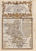
Emanuel Bowen 1720
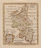
Emanuel Bowen 1758
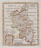
Emanuel Bowen 1758


18x24 cm
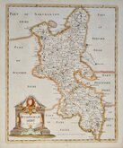
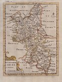
BUCKINGHAMSHIRE
Drawn & Engraved by J.Archer; Pentonville London.
Engraved for Dugdales England and Wales Delineated.
Published in Curiosities of Great Britain, England and Wales Delineated…by Thomas Dugdale. The work was first published by L. Tallis in 1842 and was republished a number of times until 1860. The maps also appeared in The Universal English Dictionary…by the Rev. James Barclay and finally in Tallis's topographical dictionary of England & Wales in 1860.
First state of the plate with the imprint for Dugdales Engalnd and Wales Delineated published in 1842 & 1846
Later hand colour with some bleeding of colour to the title. Crease bottom right corner.
Quick Links


Road Maps

Bedfordshire Maps
×