
Road Maps
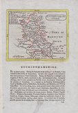
Buckinghamshire Maps
( Page 1 of 4 )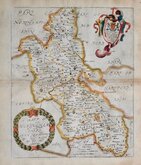
Richard Blome 1673
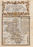
John Seller 1694 [1784]
Robert Morden 1695
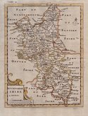
Robert Morden 1695 [1753]
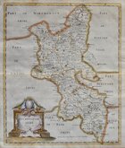
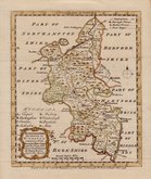
Robert Morden 1701 [c.1708]
Emanuel Bowen 1720
Emanuel Bowen 1758
Emanuel Bowen 1758


33x46 cm
CLEAR MAP WITH ROADS.
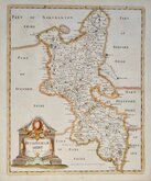
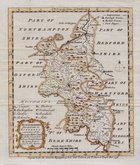
A MAP OF BUCKINGHAMSHIRE, ENGRAVED FORM AN ACTUAL SURVEY: with Improvements.
Haywood Del.t | Sudlow Sc.
Engraved for J. Harrison, No.115, Newgate Street, as the Act directs, June 27. 1788.
This series of county maps were issued at erratic intervals over a four year period bearing dates between 1787 and 1789. The atlas Maps Of The English Counties… was first issued in 1791 by J. Harrison and remained on sale for several years with various price reductions recorded.
The border is divided and numbered at 5' intervals with a graticule over the map.
Hand coloured. Staining at right centrefold affecting border and blank area of map. Small hole above the town of Linshlade (Linslade).
Quick Links


Berkshire Maps

Bedfordshire Maps
×