
Road Maps
Berkshire Maps
( Page 1 of 4 )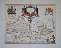
Jan Blaeu 1645
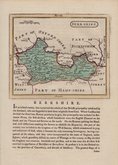
John Seller 1694 [1784]
John Seller 1694 [1784]
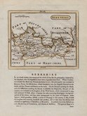
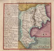
Robert Morden 1695 [1753]
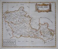
Emanuel Bowen 1720
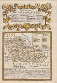
Thomas Badeslade 1742
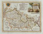
Thomas Kitchin 1751 [1786]
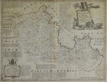
Emanuel Bowen 1756 [1763]


25x20 cm
NEATLY ENGRAVED MAP WITH PASTORAL TITLE CARTOUCHE
A Modern MAP of BERK-SHIRE, Drawn from the latest Surveys; Corrected & Improved by the best Authorities. J.Ellis Sculpt.
Printed for Robt. Sayer in Fleet Street, & Carington Bowles in St. Pauls Church yard.
First published in The New English Atlas… in 1765, the atlas became a considerable success with many editions under the title Ellis's English Atlas, being published over a period of thirty years from the offices of Robert Sayer and Carington Bowles. Most of the maps were copied from those by Thomas Kitchin in a rival publication of similar pocket size by Robert Dodsley England Illustrated first published in 1763 but which not achieve the same commercial success.
Waterstain to top margin but remains a very good example in fine later hand colour from the 1773 edition of Ellis's English Atlas.
Quick Links

Berkshire Prints

Bedfordshire Maps
×