
Bedfordshire Maps
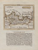
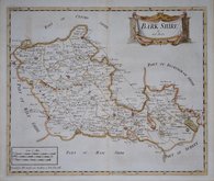
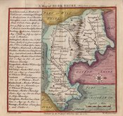
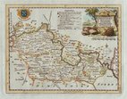
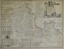
Berkshire Maps
( Page 1 of 4 )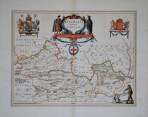
Jan Blaeu 1645
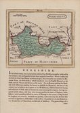
John Seller 1694 [1784]
John Seller 1694 [1784]
Robert Morden 1695 [1753]
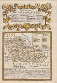
Emanuel Bowen 1720
Thomas Badeslade 1742
Thomas Kitchin 1751 [1786]
Emanuel Bowen 1756 [1763]


12x18 cm
FROM "OWEN & BOWEN" POCKET ROAD BOOK BRITANNIA DEPICTA.
BERK SHIRE
Map set below a decorative cartouche containing the title and details of the road from Oxford to Salisbury
Road map of the first part of the route verso.
Engraved by Emanuel Bowen (1693?-1767) and published in the pocket road book Britannia Depicta by Thomas Bowles from 1720 to 1764. The county maps were based on Robert Morden's small series published in The New Description and State of England... from 1701. Text descriptions compiled by John Owen.
Good clean example in neat hand colour.
For full description of the road, go to category: Maps > British Isles > RoadMaps > Owen & Bowen.
For more information on Britannia Depicta, see the category heading under Road Maps > Owen & Bowen.
Quick Links


Road Maps
Berkshire Prints
×