
Berkshire Maps
Bedfordshire Maps
( Page 1 of 4 )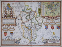
John Speed 1610 [1627]
Michael Drayton 1622
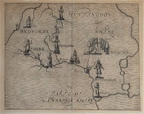
John Seller 1694 [1783]
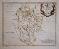
Robert Morden 1695
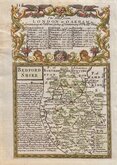
Emanuel Bowen 1720
George Rollos 1769
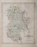
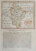
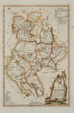
John Cary 1787 [1793]
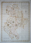
John Haywood 1788 [1791]


20x25 cm
UNCOMMON.
BEDFORDSHIRE
Neele Sculpt. Strand.
Drawn and engraved by Samuel John Neele, this series were based on John Cary's 'quarto' maps of 1793. The early publication of this series is complex with loose issues and parts issues for many counties from about 1812. The first main publication containing the complete set of county maps was The New British Traveller; or, modern panorama of England and Wales...By James Dugdale... published about 1818 by J & J Cundee. The map appeared in only three further issues under different titles in 1819 and 1820.
Re-margined bottom edge.
Betty Chambers Printed Maps of Bedfordshire Ref. 68 (i)
Quick Links


Buckinghamshire Maps
Bedfordshire Prints
×