
Berkshire Maps
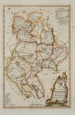
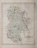
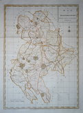
Bedfordshire Maps
( Page 1 of 4 )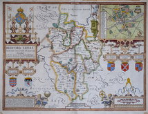
John Speed 1610 [1627]
Michael Drayton 1622
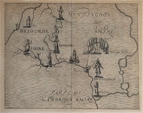
John Seller 1694 [1783]
Robert Morden 1695
Emanuel Bowen 1720
George Rollos 1769
John Cary 1787 [1793]
John Haywood 1788 [1791]


18x23 cm
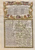
FROM "DUGDALES CURIOSITIES" ORIGINAL WASH COLOUR.
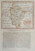
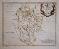
BEDFORDSHIRE.
Drawn and Engraved by J. Archer, Pentonville, London.
Drawn and engraved by Joshua Archer for publication in Curiosities of Great Britain, England and Wales Delineated…by Thomas Dugdale.
The work was first published by L. Tallis in 1842 and was republished a number of times until 1860. The maps also appeared in The Universal English Dictionary…by the Rev. James Barclay and finally in Tallis's topographical dictionary of England & Wales in 1860.
A good clean example in original wash hand colour from the 1860 edition.
Betty Chambers Printed Maps of Bedfordshire Ref. 99 (vi)
Quick Links


Buckinghamshire Maps
Bedfordshire Prints
×