
Buckinghamshire Maps
Bedfordshire Maps
( Page 1 of 4 )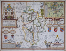
John Speed 1610 [1627]
Michael Drayton 1622
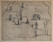
John Seller 1694 [1783]
Robert Morden 1695
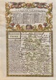
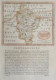
Emanuel Bowen 1720
George Rollos 1769
John Cary 1787 [1793]
John Haywood 1788 [1791]


18x25 cm
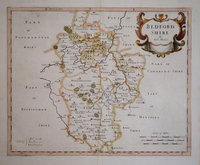
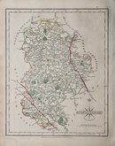
LITHOGRAPHIC MAP SHOWING ELECTORAL DIVISIONS OF THE COUNTY
BEDFORDSHIRE
Drawn by R. Creighton | Engraved by J.& C. Walker.
Lithographic transfer from an engraving by the firm of J & C Walker of a map drawn by Roger Creighton for Samuel Lewis' Topographical Dictionary of England…with a supplementary volume, comprising a representative history of England with plans describing the electoral divisions of the several counties… from 1831-1840. The plate was not used for direct intaglio printing. The map indicates only parliamentary information, county boundaries, the main roads and chief towns.
Original hand colour. Browning verso.
Betty Chambers Printed Maps of Bedfordshire Ref. 95A
Quick Links

Bedfordshire Prints

Berkshire Maps
×