
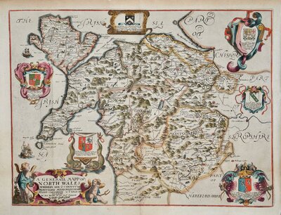
North Wales
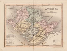
Anglesey
( Page 1 of 1 )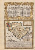
Emanuel Bowen 1720
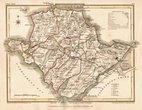
Cole & Roper 1810
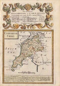
Sidney Hall 1820
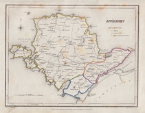
Roger Creighton 1844
Joshua Archer 1858
Weller, F. S. 1891
Anglesey Postcard 1960


12x7 cm
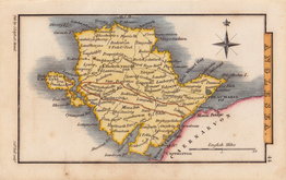
Miniature map engraved by Sidney Hall and first published in Leigh's New Pocket Atlas of England and Wales in 1820. The little atlas was popular running to ten editions until the final editions in 1842 & 3 published by George Biggs.
The Anglesey map is known in an earlier state with the road from Llanfai to the coast as a single lin proposed road.
Fine hand coloured example with Leigh's address as 18 Strand, issued from 1820 to 1831.
Quick Links

Whole of Wales
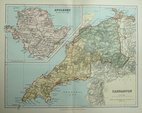
Caernarfonshire
×