
Whole of Yorkshire
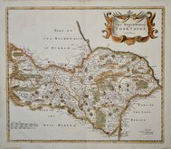
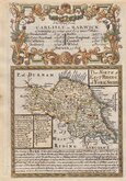
Yorkshire North Riding
( Page 1 of 3 )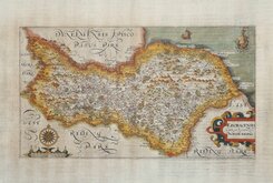
William Hole 1607
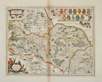
Jan Jansson 1646
Richard Blome North Riding 1673
Richard Blome Richmondshire 1673
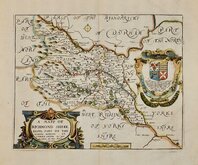
Richard Blome Richmondshire 1673
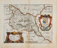
Robert Morden 1695 [1722]
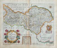
Emanuel Bowen 1720
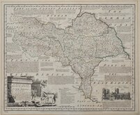
Emanuel Bowen 1763 [1777]

£150 Richard Blome North Riding
Ref: 6134hw
Add to
basket
Thanks,Your Product Has Been Added To Basket

31x25 cm
COPIED FROM SPEED.
The North Ridinge of YORKSHIRE. Discribed by Richard Blome 1672.
Produced and published by Richard Blome (1635-1705) bookseller, mapseller and publisher, printer to King William III and cosmographer to Queen Anne, in Britannia: or, A Geographical Description of the Kingdoms of England, Scotalnd and Ireland...London, Printed by Tho. Rycroft for the Undertaker, Richard Blome. 1673.
This series of maps were produced quickly following an announcement in the press by John Ogilby of his intention to produce a new work of county maps, road maps and town plans entitled Britannia. Blomes maps are crudely engraved, typical of journeyman work, and mostly copied from those of John Speed. The printing, however was of the highest standard, being carried out by Thomas Roycroft, printer to King Charles II. Richard Blome shamelessly used the same title announced by John Ogilby for his work, commencing publication in 1673.
The edition was probably on sale for four years. There was a re-issue of 1677 made up by John Wright from remaindered sheets.
Small rust spot with minor repair verso in title cartouche otherwise a very good example in good hand colour.
Ref. Whitaker Printed Maps of Yorkshire [120].
Quick Links


Yorkshire East Riding

Yorkshire West Riding
×