
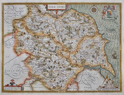
Whole of Yorkshire
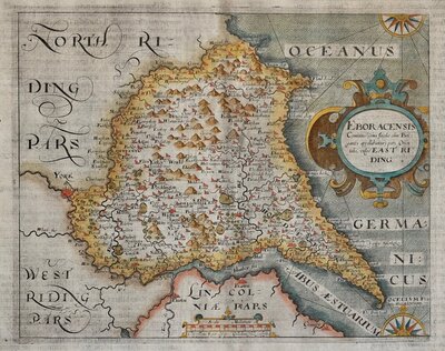
Yorkshire North Riding
( Page 1 of 3 )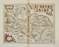
Jan Jansson 1646
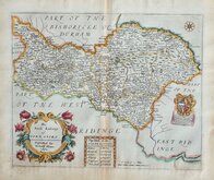
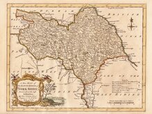
Richard Blome North Riding 1673
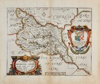
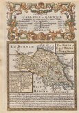
Richard Blome Richmondshire 1673
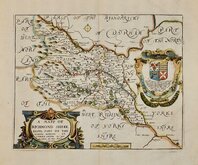
Richard Blome Richmondshire 1673
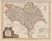
Emanuel Bowen 1720
Thomas Kitchin 1764
Joseph Ellis 1773
Emanuel Bowen 1777


20x27 cm
This series of decorative steel-plate engraved maps are commonly known by the name Thomas Moule as they were first issued from May 1830 in a series of parts of The English Counties Delineated written by him. The engraving of the plates was shared between James Bingley, W. Schmollinger and John Dower. Confusingly the engravers names were changed after the first issue on a number of plates.
Following the parts issue, the first complete edition of The English Counties Delineated was published by George Virtue in 1837 several editions followed until 1839 and the plates were extensively used thereafter by George Virtue and his son James Sprent Virtue in A Complete and Universal Dictionary of the English Language by the Rev. James Barclay until 1857.
The maps were frequently updated to reflect the rapidly developing railway network.
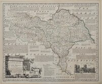
Includes vignette of York Minster.
1845 edition with the addition of several railways. Fine hand colour.
Quick Links
Yorkshire East Riding

Yorkshire West Riding
×